Wonderland Trail
This past summer found Dan, Todd and I on Mt. Rainier. We had set out to walk the 100 mile Wonderland trail encircling the mountain. This is also a very demanding trail not only due to length but the incredible elevation profile of the trail. I forget
how many times Todd told me we could have climbed up and down the mountain, but it was way more than I wanted. Anyway, Todd applied for the permits and Dan put together the hiking plan. The permits came through and with some thoughtful preparation in regards to pack weight and meals, we headed up to Longmire to begin our adventure.
Dan and Todd gear up
The first day was intentionally as short as we could make it. However, it turned out to be somewhere around 7 miles.
Todd and Dan on a section of boardwalk

Dan crossing Kautz Creek
Our fist camp was to be at a sight called Devil's Dream. Now, with a name like that, you would think we may have been a little skeptical. But, what's a name. So, reasonably tired, we strolled into camp, happy that we were done for the day. Then it started. Mosquitos. They were everywhere. There were clouds of them and the bites ensued. We don't really have too much problem with mosquitos around here as compared with other parts of the country, but this must have been some type of vacation spot, because they were overwhelming. Without a second thought, we all pulled on our rain gear, threw up our tents and hid. Though warm, it provided the needed relief from the attack. Dinner was an excercise in speed cooking/eating. After dinner, we made it an early night and went to sleep.
The author hanging his bear bag before retreating to the tent
The next morning found us quickly packing and heading up the hill to Indian Henry's Hunting Ground and an incredible view of Mt. Rainier.

After passing through Indian Henry's Hunting Ground, we worked our way over to Tahoma Creek. 
An interesting stream along the trail
Next, we dropped into Tahoma Creek Canyon. The crossing presented us with a large suspension bridge over the river. 
Todd feeling a little uneasy on the large span and tight fit

With the suspension bridge behind us, we began climbing Emerald ridge that divides Tahoma Creek and the SF Puyallup River.
Looking at the mountain on our way up Emerald Ridge

Looking down into the SF Puyallup River canyon
A parting shot before our very steep descent into the SF Puyallup
Todd and the author headed down
The SF Puyallup River
We then had a brutal climb up to Klapatche Park to our camp for the night. With a lot of effort, we made it and promptly headed to bed.
The next morning found us stuck in thick cloud cover and what would have been one of our best views of the mountain now locked behind a veil of clouds. So, we packed up and began to drop into the N Puyallup River canyon. This area presented us with multiple downed trees. Even more impressive was the trail work that had been done to to remove the largest trees.
Todd and Dan make their way into the heavily storm affected trail.

We soon made it to a rickety bridge over the N Puyallup.
Todd tests the bridge for us...a little bouncy, but good to go

We proceeded to now climb yet another hill on our way to Golden Lakes and our next camp.
Todd at stream crossing on the way up
We soon popped out in an old burn and were presented with a good view of the mountain.

We got into to camp early which gave us some time to wonder around and take a quick swim in the very cold alpine lake.
The ranger station at Golden Lakes


From Golden Lakes we dropped again into yet another canyon, that of the Mowich River
The author and Todd before we head out across the river channel of the SF Mowich River
Todd tests yet another bridge for the benefit of the group
Looking downstream on a low water Mowich River canyon
After the river crossings, we were faced with yet another climb before we made it to camp, this time at Mowich Lake.
Dan and Todd at a falls on Crater Creek, the exit stream from Mowich Lake. We must be close.

The camp at Mowich Lake is accessible by a gravel road. This meant we had to share our camp with several other people. Of the campsites we had, this was most likely the worst. (Though, I would gladly take it over Devil's Dream) The lake was great, but the people aspect really detracted from it's charm.
Todd at Mowich Lake
The author caught relaxing in camp, enjoying the amenities the site had to offer. A chair.
Mowich Lake Scenery

The next day we were up early and headed around Mowich Lake to drop Ipsut Pass and down into the Carbon River valley.
Todd getting ready to drop through the pass and follow Ipsut creek to the Carbon River.
This turned out to be a really interesting section of trail and welcome change from the over populated Mowich Lake.


The hike down Ipsut creek had been rather easy, but when we hit the confluence with the Carbon River, it turned into a hot, exposed hike the remainder of the day.

We camped that night just downstream of the suspension bridge over the Carbon River. This was not our favorite camp, but it worked. With the close proximity to a road, we saw several groups of day hikers. However, the hill we would climb tomorrow would put us back into a real wilderness setting.
With a monster of a hill looming before us, we set of early to beat the heat and stay out of the sun.
The suspension bridge over the Carbon River

It was a long climb, but once on top, the views were incredible.
Passing the Carbon Glacier on the way up


Once on top, we worked our way around to Mystic Lake.

After a near bear encounter at Mystic Lake, we continued on following the WF of the White River. This drainage looked as though a large flood event had come through fairly recently. Indeed, the trail was gone in several places and causing us to figure out our own trail for awhile.

We had one more serious climb before camp as we ascended Granite Creek and above Garda Falls. The trail proved to be tiring and Todd and I made it into camp first. Dan, being tired and prone to tunnel vision after a long, hard day on the trail proceeded to walk right by camp. We didn't let him get too far before I flagged him down.
The next day found us headed towards Sunrise Visitor Center and another primary access point for visitors. Because of the paved road, lodge and great views we encountered a lot of people during the section of trail between Sunrise and our camp at White River.


After passing by Sunset Lodge, we descended into White River campground. Here we were joined by car campers and the amenities associated with a public campground facility.
The next morning brought some light rain as we worked our way towards Paradise.
Heading into Paradise

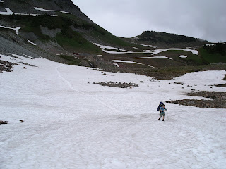
This proved to be an incredible day as we worked our way to Indian Bar. I'm sure all of us would agree that this was the best day of the trip.


Looking down into Indian Bar
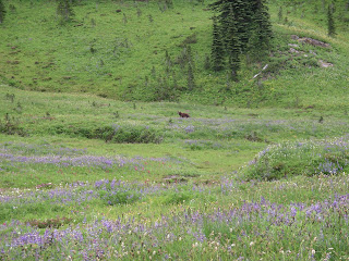
Indian Bar was by far the best camp of the whole trip. The meadow in bloom was incredible. Throw in the multiple cascading waterfalls coming into the valley and wildlife in the area and you have a fantastic camp. Also, there were only a couple campsites, so no people.
As we came down into the meadow, I spotted a couple of black bears.

What an incredible place to camp
More camp scenery


Heading out from Indian Bar

Mt. Adams shows up in the distance


The last day we pushed hard and I didn't grab any pictures. The NF Quinault was no where near the river I had remembered. The flood had ravaged the pristine pools and beauty I had seen on my previous trip.
It felt good to get back to the truck. The trip was great and one I will repeat, at least in part, sometime in the future. I am very curious to see how the major flood events of this past winter have transformed this area.
You can read Dan's write up on his blog, My Greatest Adventures.


1 comment:
Nice trip report & thanks for the great pictures! We will be headed up to Rainer this summer, hoping to summit on July 5, then begin our 6-day loop on the Wonderland Trail. Sounds like 15+ mile days will be quite challenging! Again, thanks for the great trip report! Tom
Post a Comment